On-going discovery about how our planet works is central to the research of both the Smithsonian and NASA. Data collected from instruments in space orbiting Earth and on the ground helps scientists, policy makers, and communities around the world understand and respond to climate change and other human activities that are reshaping our planet.
How do scientists collect and interpret data from a variety of sources, giving us the big picture of what we know about our home planet? We invite you to find out by exploring high-resolution data visualizations, investigating three interactive experiences, and watching short, narrated videos displayed on NASA’s hyperwall.
Image
Look For
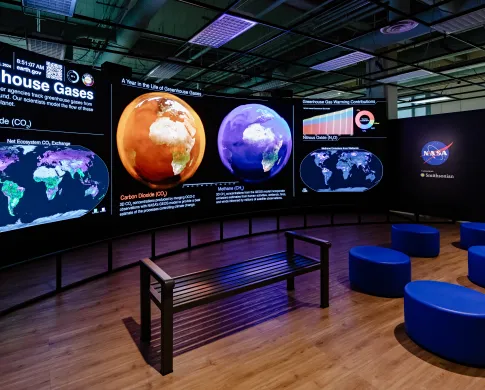
Real time satellite data about Earth’s land, water, temperature, weather, and climate
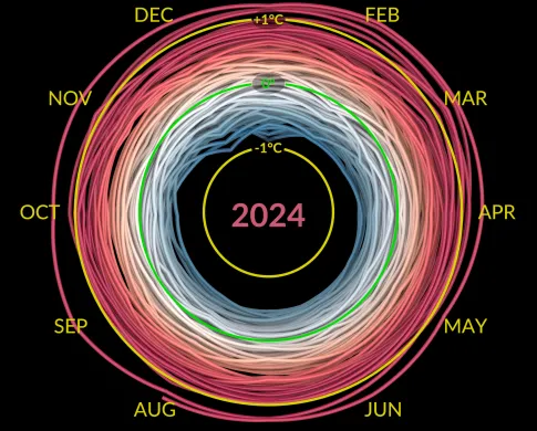
The “climate spiral” showing how average global temperatures have increased over the last 140 years
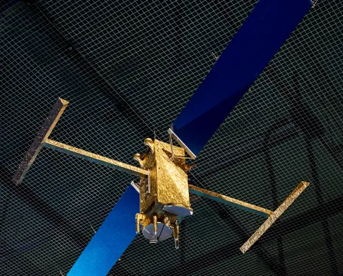
A scale model of the Surface Water and Ocean Topography (SWOT) satellite
Previous
Next
To Do:
Watch videos about how NASA and Smithsonian scientists are studying global changes.
Explore the paths of satellites circling the Earth.
Learn about how communities are using Smithsonian and NASA data to adapt to climate change.
Utilize our Visual Description. For more information visit here
Dive Deeper:
Explore our changing planet at the Earth Information Center online at EARTH.GOV